
Zoekresultaoten
De pagina "Delta 51" anmaek'n op deêze wiki.
 gemeênten over: Drenthe valt onder de waeterschappen Drents Overiesselsen Delta, Hunze en Aa's, Noôrderzielvest en Vechtstroômen. Alleviere loôpe ze deu...13 kB (1.381 woôrn) - 28 apr 2024 05:58
 Noord-Braebant is in vier waeterschappen verdeêld: 't Waeterschap Braebantsen Delta, Waeterschap Aa en Maes, Waeterschap D'n Dommel en Waeterschap Rivier'nland...9 kB (702 woôrn) - 28 apr 2024 06:06
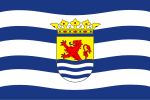 volgende: Oliefkleur bin partijen van Gedeputeêrde Staeten. ¹ 1999: GL mie Delta Anders ² PvZ = Partij vò Zeêland, toet 1998 Zeêuws-Vlaomse Volkspartij (ZVV)...22 kB (1.938 woôrn) - 28 apr 2024 06:49
 te komen; soms vonde ze dat nog nie genoeg. Verschillende eilanden in de Delta wiere daorom onder waeter ezet. Op 5 meie 1945 wier Schouwen pas vrie. 'evochte...21 kB (2.799 woôrn) - 18 apr 2024 15:02
 Ollandsen Delta Streêk(en) Goereê-Overflakkeê Oôdplekke Menheerse Statistiek Oppervlakte 422,35 km² - land 262,20 km² - waeter 160,15 km² Inweuners 51.590 Daotum...9 kB (1.134 woôrn) - 10 jan 2024 21:27
 106 km² Inweuners 664.000 (2023) Dichteid 3040 inw./km² (land) Coördinaot'n 51°55’ N 4°29’ L / <span class="geo-dec geo" title="Maps, aerial photos, and...9 kB (406 woôrn) - 18 dec 2023 16:43
 Indeling Land Nederland Provincie Noord-Braebant Waeterschap Braobantsen Delta Streêk(en) West-Braebant Baronie en Markiezaet, Braobantse Wal Oôdplekke...7 kB (315 woôrn) - 27 okt 2023 20:38
 Zoeterwoude • Zuudplas • Zwiendrecht Waeterschappen Delfland • Ollandsen Delta • Rienland • Rivierenland • Schieland en de Krimpenerwaerd Streêken Alblasserwaerd...9 kB (307 woôrn) - 26 apr 2024 08:15
 8 km² Inweuners 159.000 (2023) Dichteid 1450 inw./km² (land) Coördinaot'n 51°41’ N 5°18’ L / <span class="geo-dec geo" title="Maps, aerial photos, and...1 kB (73 woôrn) - 23 okt 2023 17:28
 3 km² Inweuners 186.000 (2023) Dichteid 1483 inw./km² (land) Coördinaot'n 51°35’ N 4°46’ L / <span class="geo-dec geo" title="Maps, aerial photos, and...2 kB (120 woôrn) - 31 okt 2023 08:25
 1 km² Inweuners 244.000 (2023) Dichteid 2780 inw./km² (land) Coördinaot'n 51°26’ N 5°29’ L / <span class="geo-dec geo" title="Maps, aerial photos, and...1 kB (32 woôrn) - 23 okt 2023 17:14
 Indeling Land Nederland Provincie Noord-Braebant Waeterschap Braobantsen Delta Streêk(en) West-Braebant Baronie en Markiezaet, Braobantse Wal Oôdplekke...4 kB (135 woôrn) - 27 okt 2023 20:39
 waeter 3 km² Inweuners 50.000 (2023) Dichteid 773 inw./km² (land) Coördinaot'n 51°41’ N 5°4’ L / <span class="geo-dec geo" title="Maps, aerial photos, and...1 kB (36 woôrn) - 15 sep 2023 06:09
 3 km² Inweuners 228.000 (2023) Dichteid 1809 inw./km² (land) Coördinaot'n 51°33’ N 5°4’ L / <span class="geo-dec geo" title="Maps, aerial photos, and...1 kB (62 woôrn) - 27 okt 2023 14:24
 waeter 3 km² Inweuners 22.000 (2023) Dichteid 830 inw./km² (land) Coördinaot'n 51°42’ N 4°52’ L / <span class="geo-dec geo" title="Maps, aerial photos, and...1 kB (33 woôrn) - 18 oes 2023 06:34
 27 km² Inweuners 58.000 (2023) Dichteid 289 inw./km² (land) Coördinaot'n 51°46’ N 4°57’ L / <span class="geo-dec geo" title="Maps, aerial photos, and...1 kB (61 woôrn) - 18 oes 2023 07:52
 waeter 1 km² Inweuners 78.000 (2023) Dichteid 729 inw./km² (land) Coördinaot'n 51°32’ N 4°28’ L / <span class="geo-dec geo" title="Maps, aerial photos, and...1 kB (78 woôrn) - 23 okt 2023 17:48
 Loôn op Zand Oppervlakte 51 km² - land 50 km² - waeter 1 km² Inweuners 24.000 (2023) Dichteid 477 inw./km² (land) Coördinaot'n 51°37’ N 5°4’ L / <span...1 kB (26 woôrn) - 18 oes 2023 17:57
 Indeling Land Nederland Provincie Noord-Braebant Waeterschap Braobantsen Delta Streêk(en) West-Braebant Baronie en Markiezaet, Braobantse Wal, Westoek...4 kB (99 woôrn) - 27 okt 2023 20:33
 ~0 km² Inweuners 46.000 (2023) Dichteid 1466 inw./km² (land) Coördinaot'n 51°25’ N 5°24’ L / <span class="geo-dec geo" title="Maps, aerial photos, and...1 kB (18 woôrn) - 18 oes 2023 20:03


