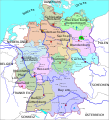
Plaetje:Political map of Germany vector drawing.svg

Pagina-inhoud wordt niet ondersteund in andere talen.
Uut Wikipedia

Volledige resolutie(SVG-bestand, nominaal 512 × 563 pixels, bestandshroôtte: 295 kB)

Dit bestand kom von Wikimedia Commons en kan oôk in aorre project'n gebruukt worr'n. De pagina mè de bestandsbeschrievienge wòdt hieronder weergegeev'n.

Saemenvattieng

Beschrijving Political map of the Germany vector illustration. Graphics of map of the Germany with a cities, capitals, regions and international boundaries shown.
Datum
Bron openclipart.org
Auteur Helm42
Toestemming
(Hergebruik van dit bestand)
Public domain (see openclipart.org/share, "We use the Creative Commons Zero 1.0 Public Domain License every time an artist uploads a piece of clipart to Openclipart to make it clear the artist is releasing the creative work for anyone to use for any reason, even commercially."
 
W3C-validity not checked.

Licentie

Creative Commons CC-Zero Dit bestand is beschikbaar onder Creative Commons CC0 1.0 Universele Public Domain Dedication.
De persoon die een werk voorziet van deze licentie stelt dit werk beschikbaar aan het publieke domein door, voor zover dit wettelijk is toegestaan, afstand te doen van alle rechten op het werk in de zin van het auteursrecht, met inbegrip van alle aanverwante of naburige rechten. U kunt het werk kopiëren, aanpassen, distribueren en uitvoeren, ook voor commerciële doeleinden, zonder dat u daarvoor toestemming hoeft te vragen.

Bijschriften

Beschrijf in één regel wat dit bestand voorstelt

Items getoond in dit bestand

beeldt af Nederlands

licentie Nederlands

CC0 Nederlands

21 mei 2011

Bestandsgeschiedenisse

Klik op 'n datum/tied om 't bestand te zien zoas 't van d'r tied woas.

Datum/tiedMiniatuurOfmetiengenGebrukerOpmerkienge
hudige versie28 okt 2017 01:14Miniatuuraofbilding vò de versie von 28 okt 2017 om 01:14512 × 563 (295 kB)JoKalliauertrimmed, made file valid (eccept metadata)
22 oes 2017 10:59Miniatuuraofbilding vò de versie von 22 oes 2017 om 10:59512 × 725 (340 kB)Seagull123=={{int:filedesc}}== {{Information |Description=Political map of the Germany vector illustration. Graphics of map of the Germany with a cities, capitals, regions and international boundaries shown. |Source=[https://openclipart.org/detail/139753/politic...

Dit bestand òdt op de volgende pagina gebruukt:

Metadata