
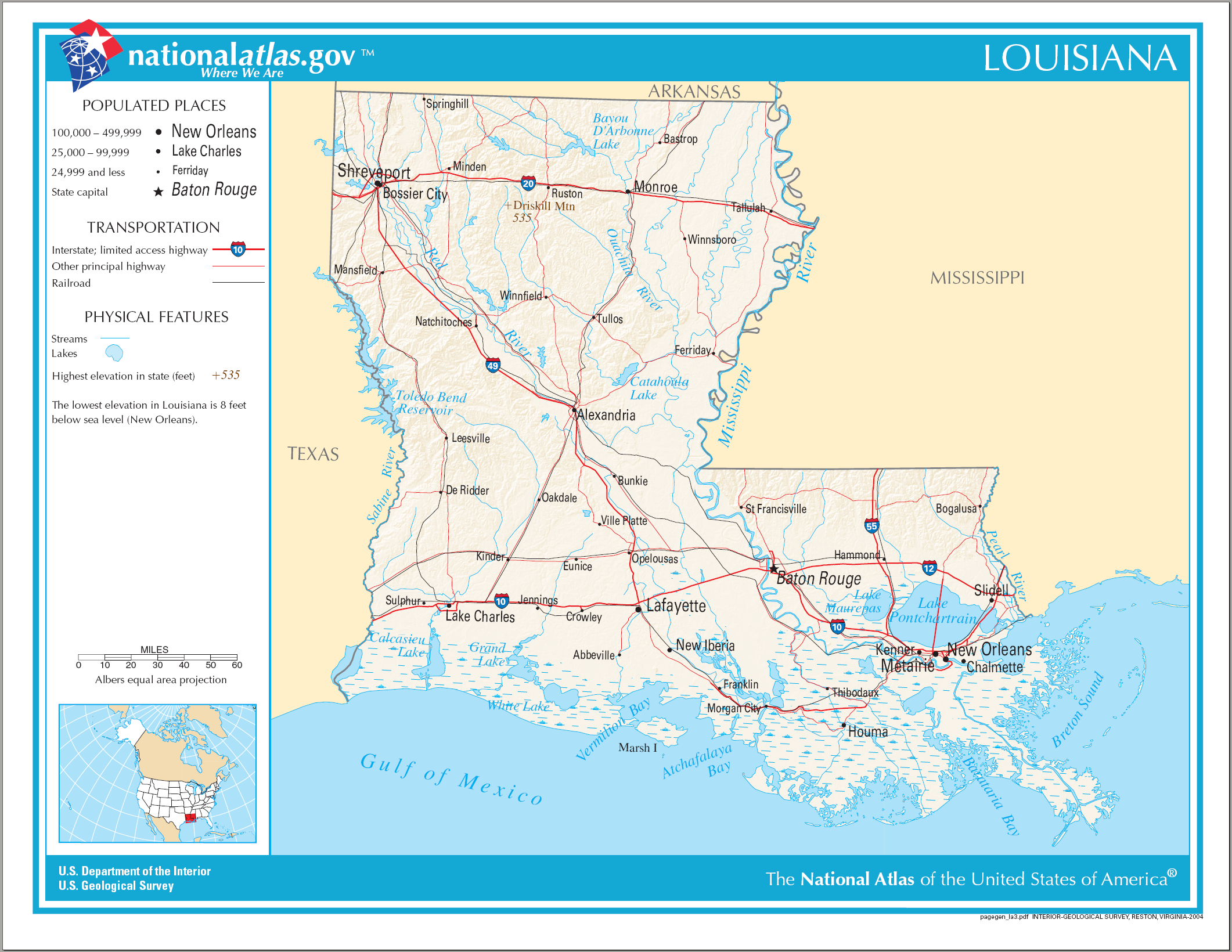
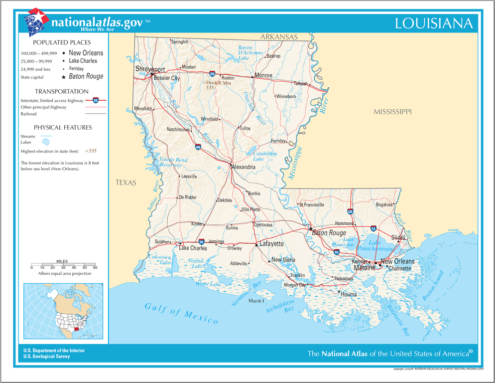
Plaetje:Map of Louisiana NA.png
Grootte van deze voorvertoning: 776 × 600 pixels. Andere resoluties: 311 × 240 pixels | 621 × 480 pixels | 994 × 768 pixels | 1.280 × 989 pixels | 2.122 × 1.640 pixels.
Volledige resolutie (2.122 × 1.640 pixels, bestandsgroôtte: 1,78 MB, MIME-type: image/png)
Saemenvattieng
| Beschrijving | Map of Louisiana |
| Datum | |
| Bron | National Atlas |
| Auteur |
Licentie
This map was obtained from an edition of the National Atlas of the United States. Like almost all works of the U.S. federal government, works from the National Atlas are in the public domain in the United States.
Online access: NationalAtlas.gov | 1970 print edition: Library of Congress, Perry-Castañeda Library
|
Bestandsgeschiedenisse
Klik op 'n datum/tied om 't bestand te zien zoas 't van d'r tied woas.
| Datum/tied | Miniatuur | Ofmetiengen | Gebruker | Opmerkienge | |
|---|---|---|---|---|---|
| hudige versie | 14 oes 2006 21:00 | | 2.122 × 1.640 (1,78 MB) | Huebi~commonswiki | {{Information| |Description=Map of Louisiana |Source=[http://www.nationalatlas.gov National Atlas] }} Category:Maps of the United States Category:Maps of Louisiana {{PD-USGov-Atlas}} |
Bestandsgebruuk
Dit bestand òdt op de volgende pagina gebruukt:
Globaal bestandsgebruik
De volgende andere wiki's gebruiken dit bestand:
- Gebruikt op de.wikipedia.org
- Gebruikt op en.wikipedia.org
- Gebruikt op fr.wikipedia.org
- Gebruikt op hsb.wikipedia.org
- Gebruikt op hu.wikipedia.org
- Gebruikt op incubator.wikimedia.org
- Gebruikt op it.wikipedia.org
- Gebruikt op lt.wikipedia.org
- Gebruikt op mr.wikipedia.org
- Gebruikt op stq.wikipedia.org
- Gebruikt op szl.wikipedia.org