
Plaetje:Maastricht-topografie.jpg

Grootte van deze voorvertoning: 567 × 600 pixels. Andere resoluties: 227 × 240 pixels | 454 × 480 pixels | 726 × 768 pixels | 968 × 1.024 pixels | 1.759 × 1.860 pixels.
Volledige resolutie (1.759 × 1.860 pixels, bestandsgroôtte: 2,31 MB, MIME-type: image/jpeg)
Saemenvattieng
| Beschrijving |
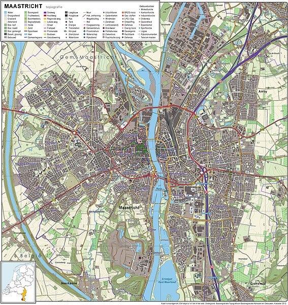
Nederlands: Topografisch beeld van de stad Maastricht.
Op basis van de GML open geodata van de BRT/Top10NL (basisregistratie Topografie, Kadaster 2012), vrijgegeven door Kadaster op 30-11-2012 onder de Creative Commons BY licentie. Gebouwvlakken vanuit Open Geodata BAG extract (december 2012). Samenstelling en kleurenschema: Jan-Willem van Aalst, met QuantumGIS en Photoshop. |
| Datum | |
| Bron | Eigen werk |
| Auteur | Janwillemvanaalst |
Licentie
Ik, de auteursrechthebbende van dit werk, maak het hierbij onder de volgende licentie beschikbaar:
Dit bestand is gelicenseerd onder de Creative Commons-licentie Naamsvermelding-Gelijk delen 3.0 Unported
- De gebruiker mag:
- Delen – het werk kopiëren, verspreiden en doorgeven
- Remixen – afgeleide werken maken
- Onder de volgende voorwaarden:
- naamsvermelding – U moet op een gepaste manier aan naamsvermelding doen, een link naar de licentie geven, en aangeven of er wijzigingen in het werk zijn aangebracht. U mag dit op elke redelijke manier doen, maar niet zodanig dat de indruk wordt gewekt dat de licentiegever instemt met uw werk of uw gebruik van zijn werk.
- Gelijk delen – Als u het werk heeft geremixt, veranderd, of erop heeft voortgebouwd, moet u het gewijzigde materiaal verspreiden onder dezelfde licentie als het oorspronkelijke werk, of een daarmee compatibele licentie.
Bestandsgeschiedenisse
Klik op 'n datum/tied om 't bestand te zien zoas 't van d'r tied woas.
| Datum/tied | Miniatuur | Ofmetiengen | Gebruker | Opmerkienge | |
|---|---|---|---|---|---|
| hudige versie | 14 jan 2013 07:58 | | 1.759 × 1.860 (2,31 MB) | Janwillemvanaalst | Added various topographic improvements, which were already available in the BRT open-geodata source files: - Symbols for special physical appearances of land types such as "swampy terrain" - Symbol for carpool parking + large open parking spaces (in ad... |
| 5 jan 2013 19:37 |  | 1.759 × 1.860 (2,26 MB) | Janwillemvanaalst | Various rendering improvements, following the advice of several topographic experts. Scale remains unchanged. | |
| 30 dec 2012 13:10 |  | 1.759 × 1.860 (2,17 MB) | Janwillemvanaalst | Map redrawn using updated (Dec. 2012) open geodata Dutch government base registries BRT + BAG. Rendered using QuantumGIS and Photoshop. | |
| 17 feb 2012 12:40 |  | 2.263 × 2.196 (2,53 MB) | Janwillemvanaalst |
Bestandsgebruuk
Hin enkele pagina gebruukt dit bestand.
Globaal bestandsgebruik
De volgende andere wiki's gebruiken dit bestand:
- Gebruikt op sl.wikipedia.org